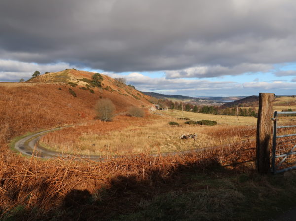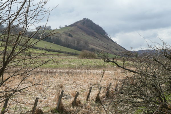
Sgrìobh mi an seo mar-thà mu Bheinn Uais agus Chnoc Fhaoighris, agus an turas seo tha mi airson sùil a thoirt air cnoc ionadail eile as toil leam, Cnoc Fearralaidh. ‘S e feart-tìre comharraichte a th’ ann a’ coimhead bho gach taobh, ach gu sònraichte bhon rathad eadar Inbhir Pheofharain agus Srath Pheofhair, agus ‘s e cuairt ghoirid agus cuimseach furasda a th’ ann bhon àite-parcaidh bheag aige fhèin (ri ruigsinn bho thaobh Loch Ùsaidh). Tha cuairtean nas fhada ‘s nas dùbhlanaiche ann cuideachd, bho Srath Pheofhair no slighe Cnuic Mhòir ‘s Druim a’ Chait – molaidhean air www.walkhighlands.co.uk .
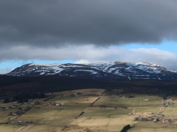
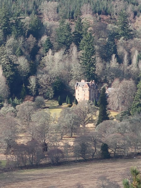
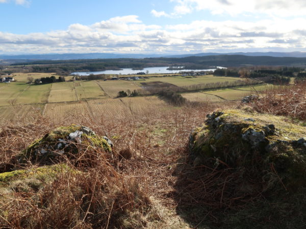
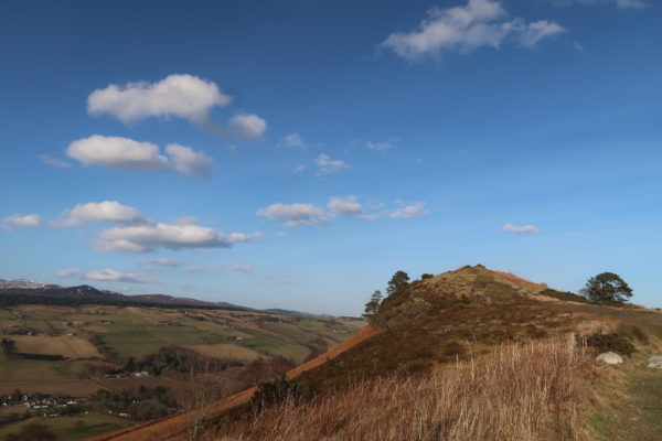
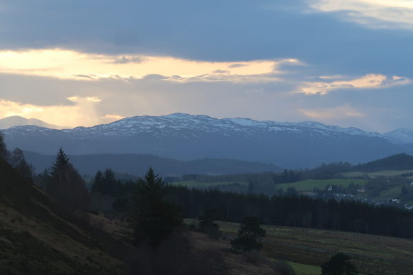
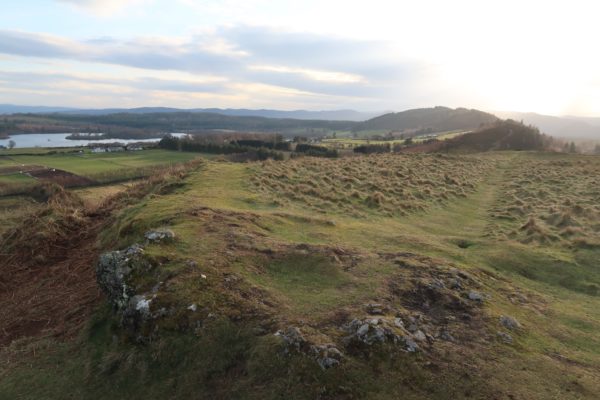
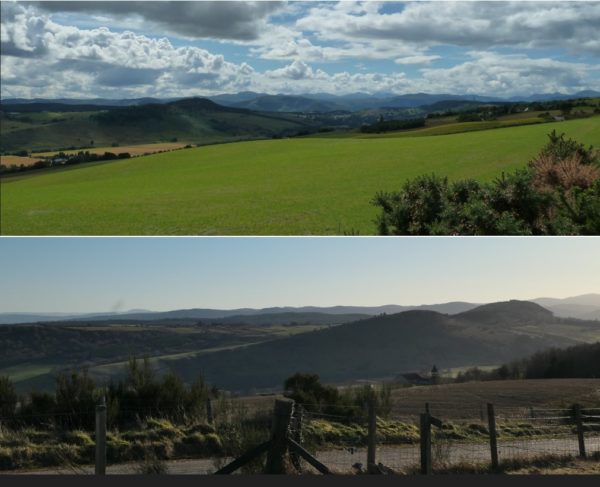
‘S e druim fada, cas a th’ ann, sìnte bhon ear chun an iar, mu 200m a dh’àirde, le seallaidhean soilleir anns gach àird – beanntan Srath Chonain, Beinn Uais, Linne Chrombaidh is Cnoc Neig, gu Creag Phàdraig taobh Inbhir Nis agus deas thairis air Loch Ùsaidh gu Moreibh is chun a’ Mhonaidh Ruaidh. Chithear Inbhir Pheofharain chun an ear agus Caisteal Leòid is Srath Pheofhair chun an iar. A bharrachd air a bhith fradharcach, bha cudromachd ro-innleachdail aige sna linntean a dh’fhalbh, oir tha làrach dùin mhòir ghlainnaichte bho Linn an Iarainn air a mhullach chòmhnard. Chìtheadh na naimhdean tighinn gun teagamh sam bith, agus bhiodh e doirbh dhaibh ionnsaigh a thoirt air an dùn ri bruthach is e cho cas air cha mhòr gach taobh.
Tha e coltach gun tàinig an t-ainm Cnoc Fearralaidh (no Farralaidh no Fearghalaidh) bho far-eileach, “àite àrd nan clachan”, a’ dèanamh iomradh air an dùn.
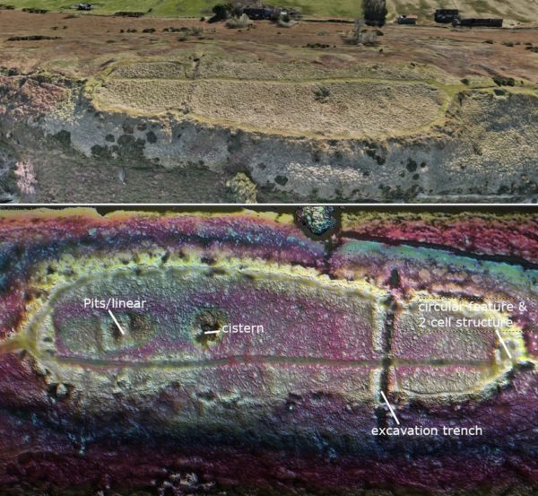
Tharraing an dùn arc-eòlaichean thar nan linntean, is e an innleadair John Williams am fear a bu tràithe dhiubh sna 1770an. Tha na trì truinnsichean domhainn aige rim faicinn fhathast a’ dol thairis air làrach an dùin, tro na gàrraidhean, mar a chithear san adhar-dhealbh aig Andy Hickie, leasaichte le photogrammetry gus na feartan a shealladh gu soilleir. (Faic an obair shònraichte aige an seo: https://www.facebook.com/people/Andys-Aerial-Archaeology-Photogrammetry-Site/100068170431509 ) Sgrìobh Williams mu fheartan nach eil rim faicinn tuilleadh, m.e. gun robh pàirt den ghàrradh mu 7m a dh’àirde bhon fho-chreag. An-diugh fhèin chithear an dealbh-iomaill chreagach gu furasda, is na gàrraidhean mu 4.5m air leud mar chuibheas.
Tha beachdan eadar-dhealaichte ann mu ghlainneachadh, a chithear ann an iomadh dùn-chnuic Albannach, a tha air abhrachadh nuair a leaghas eileamaidean anns na clachan, uaireannan le coltas glainne, agus mar sin ceanglaidh iad ri chèile. Bhiodh fiodh air a chleachdadh gu farsaing san dùn, mar sin bidh cuid a’ creidsinn gur e tubaist no ionnsaigh is losgadh le naimhdean as coireach, ach leis gu bheil feum ann air teas uabhasach àrd agus leantainneach, ‘s dòcha cuideachd gur ann a dh’aon ghnothaich a rinneadh e gus an gàrradh a neartachadh – chan eil cinnt ann. Ach chì thu iomadh clach fhathast le fianais glainneachaidh. (Faic: https://brigantesnation.com/how-to-vitrify-a-fort .)
Tha sgeulachdan gu leòr ann cuideachd mun chnoc, nam measg tè mu bhàs Fhinn MhicCumhail, an seann ghaisgeach Ceilteach, tro fheall, air a h-innse le Hugh Miller is eile. Agus dh’fhàisnich Coinneach Odhar, Fiosaiche Bhrathainn (is a’ chlach dhraoidheil aige ann an Loch Ùsaidh), gun èireadh uisge an loch às an tobar air mullach a’ chnuic agus gun tuilicheadh e Srath Pheofhair – ma thuiteas Clach an Iolaire an treas turas.
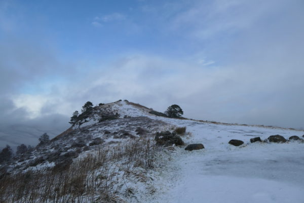
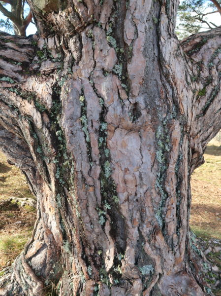
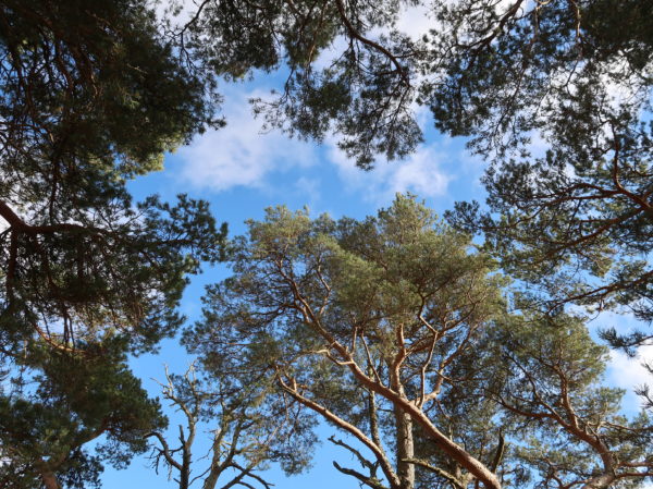
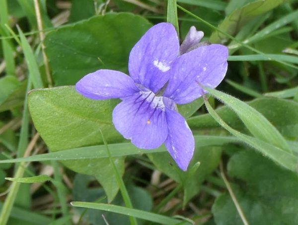
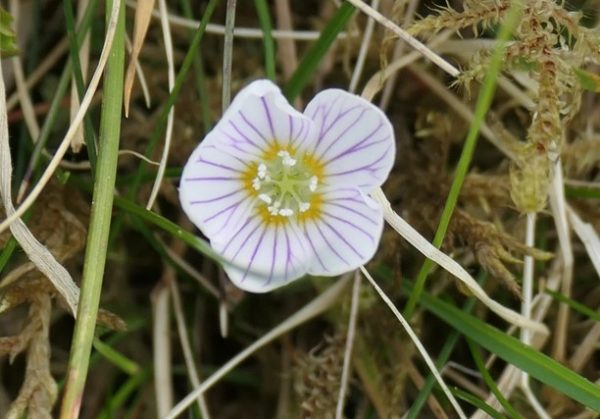
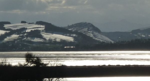
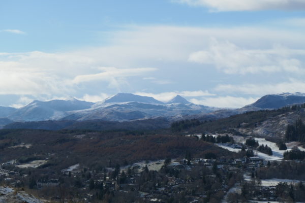
Ach ma bhios tu air a’ chnoc dìreach airson cuairt agus nan seallaidhean àlainn, tha tuilleach ‘s gu leòr ann a thoilicheas an t-sùil, le flùraichean fiadhaich, seann ghiuthais-Albannach, agus tòrr eun, beag is mòr, nam measg na clamhanan-gobhlach à stèisean-beathachaidh Thollaidh faisg air làimh. Bha e tlachdmhor san t-sneachd cuideachd nuair a bha mi ann sa gheamhradh. Uairbha fiù ‘s chalet fiodha sgeadachail ann airson biadh beag a reic as t-samhradh dhan luchd-tadhail bhon spa, c. 1910 – 1960an – thoiribh picnic leibh fhèin a-nis! Dealbh dheth an seo: https://www.ambaile.org.uk/asset/33064/1/EN33064-the-chalet-knockfarrel-strathpeffer.htm/
Carson nach fheuch sibh e, mura robh sibh ann fhathast?
++++++++++++++++++++++++++++++++++++++++++++++++++++++++++++++++++++++++++
I’ve written here in the past about Ben Wyvis and Fyrish, and this month I thought I’d look at another of my favourite local hills, Knockfarrel. It’s a very striking feature in the landscape seen from any angle , especially on the way from Dingwall to Strathpeffer, and is a short, fairly easy walk from its own wee carpark (approach from Loch Ussie), or longer, more challenging ones from Strathpeffer or via Cnoc Mòr and the Cat’s Back. Have a look for the various routes on www.walkhighlands.co.uk.
It’s a long, steep ridge lying east to west, about 200m high, and has clear views in all directions – the Strathconon hills, Ben Wyvis, down the Cromarty Firth to Nigg Hill, to Craig Padraig by Inverness, and south across Loch Ussie towards Moray and the Cairngorms. Dingwall is visible to the east, and Castle Leod and Strathpeffer to the west. As well as being scenic, this position clearly had strategic importance in the past, as there are the remains of a large vitrified Iron Age fort on the flattish top. You would certainly see enemies coming, and they’d have a hard time attacking the fort uphill as it’s so steep most of the way round.
The Gaelic name of the hill, Cnoc Fearralaidh (Farralaidh / Fearghalaidh), is likely to come from far-eileach, meaning high stone-place, no doubt a reference to the fort.
The fort has attracted archaeologists over the years, the earliest being engineer John Williams in the 1770s. His excavation trenches across the ramparts at three points are still prominent today, as can be seen in the aerial view by Andy Hickie (see his wonderful work here: https://www.facebook.com/people/Andys-Aerial-Archaeology-Photogrammetry-Site/100068170431509 ), enhanced to show the features more clearly. Williams’ written reports usefully describe features no longer visible, and help illustrate the vast dimensions of the fort’s ramparts – the walls were still much higher then, up to 7 meters from bedrock in one place. Even today the stony outline of the ramparts is easily seen, and the average width of the walls is 4.5 metres.
There are various theories about vitrification, seen in many Scottish hillforts – basically heating rock until certain elements in it (“flux”) begin to melt, fusing the stones together. Timber would have been widely used around the fort, so accidental or enemy fires are one idea. But vitrification needs intense, sustained heat, so might well be deliberate, e.g. to form a more stable wall. The jury is still out. But you can still see the signs of it in the remaining stones, all around the ramparts. More on this: https://brigantesnation.com/how-to-vitrify-a-fort
There are also legends surrounding the hill, including one about the death there by treachery of ancient Celtic hero Finn MacCumhaill, as told by Hugh Miller among others, and a prophesy by the Brahan Seer (whose magic stone allegedly lies in nearby Loch Ussie) about the water in the loch rising up in the well on the hill and one day flooding Strathpeffer and allowing ships to moor – if the Eagle Stone there falls down one last (third) time.
But if you’re just up there for a walk and the magnificent views, there’s more than enough to delight the eye, with wild flowers, ancient Scots pines, and lots of bird life, large and small – including red kites from nearby Tollie feeding station. It even had its charms in the snow when I was up there recently. And from 1910 to the 1960s there was even a decorative wooden chalet there, built to provide refreshments to spa guests who made it up there in the summer – take your own picnic now! Photo of the chalet here: https://www.ambaile.org.uk/asset/33064/1/EN33064-the-chalet-knockfarrel-strathpeffer.htm/
Why not give it a try, if you’ve never been?
