Ainmean-àite 5 – Beurla agus Beurla Ghallda
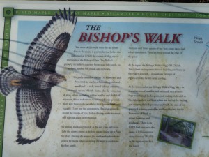 Mar a chunnaic sinn mar-thà, ‘s e eachdraidh fhada agus gu ìre chaochlaideach a bha aig Machair Rois. Ach tha aon rud ann a bha seasmhach: bha an-còmhnaidh ùidh mhòr aig luchd-riaghlaidh na h-eaglaise agus na stàite anns an dùthaich thorraich fhasgaich aig ceann Linne Mhoireibh. Bha cudromachd ro-innleachdail aig an làrach seo – dh’fheumadh feadhainn a bha a’ strì airson cumhachd poilitigiche, armailtiche, eaconamiche no cràbhaiche air a’ Ghàidhealtachd, air tìr no air muir, bunait a stèidheachadh an sin. Thàinig na daoine seo – rìghrean, uaislean, easbaigean, seanailearan, marsantan – no na riochdairean aca, gu tric à ceann a deas na h-Alba (no fiù ‘s na b’ fhaide air falbh) agus ri ùine thàinig Beurla Gallda no Beurla còmhla riutha.
Chì sinn air na seann mhapaichean (Pont, Blaeu ammsa) gu bheil mòran chruthan Beurla aig ainmean-àite far an robh cruth Gàidhlig aig muinntir na sgìre: Abbotshaven seach Port an Ab, Hilton seach Baile a’ Chnuic, Castle Tarbat seach Caisteal Baile an Lòin (Ballone), agus ri ùine nochdaidh eiseimpleiren ùra air na mapaichean: Mounteagle seach Cnoc na h-Iolaire, Broomton seach Baile a’ Bhealaidh, agus -fields gun chrìoch. Fhuair na sgrìobhadairean-mapa fios bho dhaoine ‘cudromach’ an àite, nach robh gu trice às an sgìre fhèin, fiù ‘s nam b’ e daoine foghlaimte agus fiosrachail a bh’ annta – ministearan, luchd-teagaisg, fir-lagha amsaa. ‘S dòcha gun robh iad den bheachd gur e ainmean ‘nas fheàrr’, nas fheumaile no fiù ‘s nas sìobhailichte a bh’ anns na h-eadar-theangaidhean seo, agus ri ùine bhiodh cuid de mhuinntir na sgìre a’ creidsinn seo cuideachd, agus iad a’ cleachdadh Beurla co-dhiù airson ghnothaichean na b’ fhoirmeile.
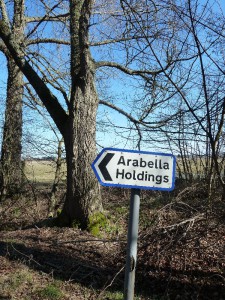 Thug luchd na Beurla seo, no in-imrichean saidhbhreachail as an dèidh (no uaislean ionadail ‘Beurlaichte’), ainmean le brìgh phearsanta air na dachaighean agus oighreachdan aca cuideachd: Brucefield seach Cnoc an Tighearna, Arabella seach Am Bog, Ankerville seach Cinn-dèis (Kindeace), Petley, Kimberley, amssa.
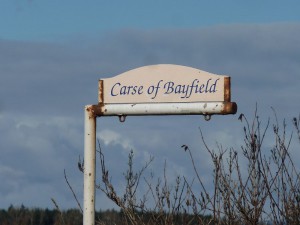
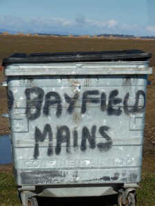
Ach bha buaidh na Beurla Gallda ann cuideachd, an dà chuid bho rùnairean is eile às a’ Ghalltachd aig àm nam manachainnean ‘s nan rìghrean, ‘s dòcha ri fhaicinn ann an Hiltoun, Newtoun, Meikle Rany (mapa aig Pont c. 1590), agus bhon fheadhainn eile a thàinig tro na linntean nan tuathanaich, ceàrdan agus iasgairean – Hirsel (croit-caorach bheag), Skinnerton, Fishertown, Carse of Bayfield. Thàinig na daoine sin, à Moireibh no na b’ fhaide gu deas, a dh’obair, gu ìre mhòr, chan ann a riaghladh, agus bha iadsan a’ fuireach taobh ri taobh le muinntir Ghàidhealach na sgìre. Tha e coltach gur e sin an t-adhbhar air an uabhas de dh’ainmean le eilamaidean measgaichte – ainmean Gàidhlig le facal Beurla no Beurla Gallda air a chur riutha – mar Little Tarrel, Easter Rarichie, Lower Pitcalzean, Loans of Fearn, Clay of Allan, Balnapaling, Nigg Mains, amsaa.
Ann an Ros an Ear, agus ann am Machair Rois gu h-àraidh, tha stòras air leth pailt de dh’fhianaisean eachdraidheil, cruinn-eòlach agus sòisealta anns na h-ainmean àite. Le bhith a’ sealltainn gu mionaideach air mapa OS an latha an-diugh, gheibh sinn a-mach cò na sluaghan a bha ann, dè na cànan a bhathar a’ bruidhinn, dè an obair a bha aig na daoine tro na linntean, cò aig a bha cumhachd phoiliteagach no eaglaiseil, agus cuin, agus cò ris a bha am fearann coltach linntean air ais. Bha agus tha am pìos fearainn seo tlachdmhor is luachmhor do dhaoine bhon taobh a-muigh.
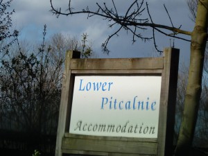 Tha am mapa ag atharrachadh fhathast; air mapaichean OS nas ùire chì sinn na h-ainmean as aosta còmhla ris an fheadhainn nas nuaidhe: Pitcalzean agus Balnabruaich dlùth ri taobh ainmean mar ‘Nigg Oil Terminal Graving Dock’ agus ‘Helipad’. Agus ann an cuid bhliadhnaichean eile, leis an leasachadh as ùire san sgìre, ‘s dòcha gum bi seo ag atharrachadh a-rithist, agus sinn a’ sealltainn air mapa Ros an Ear air a bheil aon uair eile Cnoc a’ Mhuilinn Ghaoithe.
*****************************************************************************************
Placenames 5: English and Scots
As we have already seen, Easter Ross has had a long and fairly colourful history. But one thing has remained constant: there has always been immense interest on the part of church and state rulers in the fertile sheltered land at the head of the Moray Firth. This site was of strategic importance; anyone who was battling for political, military, economic or religious control of the Highlands, by land or sea, had to establish a base here. These people – kings, nobles, bishops, generals, merchants – or their representatives all came into the area, often from the south of Scotland (or even further afield), and in the course of time the Lowland Scots or English languages came with them.
 We see on the old maps from the 1590s on (Pont, Blaeu etc) that there were many English forms suddenly appearing for places which already had Gaelic names as used by the local population: Abbotshaven instead of Port an Ab , Hilton instead of Baile a’ Chnuic, Castle Tarbat instead of Baile an Lòin (Ballone). Over time new specimens appeared on the maps: Mounteagle instead of Cnoc na Iolaire, Broomton instead of Baile a’ Bhealaidh, and umpteen placenames ending in -field. The map-makers got their information from the ‘important’ folk of the area, who often weren’t locals, even if they were educated, well-informed individuals such as ministers, teachers, lawyers etc. Maybe they actually believed that these Anglicised versions were ‘better’, more useful, or even more ‘civilised’, and over time maybe even some of the locals began to believe that too, as they had already started using English for more formal business.
These English-speakers, and later gentry incomers (or Anglicised local gentry) also gave their homes or estates names with personal significance to them: Brucefield instead of the existing name Cnoc an Tighearna (The Lord’s Hill), Arabella instead of Am Bog, Ankerville instead of Cinn-dèis (Kindeace), Petley, Kimberley etc.
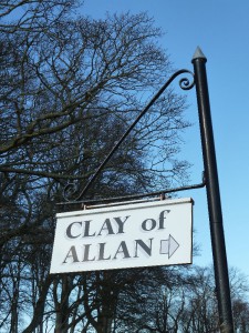 But there was a Scots influence too, both from court administrators and others from the Lowlands at the time of the monasteries and the kings, probably as seen in the names Hiltoun, Newtoun, Meikle Rany on Pont’s map of 1590, and also from those who came over the centuries as farmers or farmworkers, tradesmen and fishermen: Hirsel (small sheep croft), Skinnerton, Fishertown, Carse of Bayfield etc. These people from Moray and further south came, to a large extent, as ordinary workers rather than administrators, and they would have lived side-by-side with the local Gaelic-speaking population. It’s likely that that is the reason for the large number of mixed names with Gaelic roots and English or Scots appendages, like Little Tarrel, Easter Rarichie, Lower Picalzean, Loans of Fearn, Clay of Allan, Balnapaling, Nigg Mains etc.
In Easter Ross, and especially on the Seaboard, there’s a wealth of historical, geographical and social evidence in the local placenames. If we look closely at the OS maps even today, we can find out which peoples lived there in the past, what languages were spoken, what work people did there over the centuries, who had the political or ecclesiastical power (and when), and what the land looked like centuries back. This piece of the country was and still is attractive and valuable to those from outside its borders.
 The map is still changing. On recent OS maps we see the oldest names side by side with modern ones: Pitcalzean and Balnabruaich close to names like ‘Nigg Oil Terminal Graving Dock’ and ‘Helipad‘. And it may not be long before that changes again, and (given the latest developments) somewhere on the map of Easter Ross we will once again have a Cnoc a’ Mhuillinn Ghaoithe – Windmill Hill.